What if cities could rehearse the monsoon before the first drop of rain falls?
What if a municipal officer could see, in real time, which neighbourhood would flood first, how deep the water would rise, where traffic would choke, and which intervention could reduce the damage?
Every monsoon, roads disappear under water, traffic comes to a standstill, and officials rush to respond once the damage is already done. For years, this has been how urban flooding has been handled in India.
On a campus in Gujarat, a team is bringing together physics, artificial intelligence and the everyday realities of Indian cities to help officials anticipate these problems before they unfold.
At IIT Gandhinagar, the AI Resilience and Command (ARC) Centre is trying to help cities prepare for floods before the damage begins.
Why cities need more than another flood report
Every monsoon, disruption feels inevitable. Roads turn into rivers. Underpasses vanish. Commute times double. The scramble that follows is routine.
For Prof Udit Bhatia, Principal Investigator of the Urban Flooding Module under the AI Centre of Excellence (AICoE) for Sustainable Cities at IIT Gandhinagar, that repetition raised a question: in an era defined by artificial intelligence, why were cities still reacting instead of anticipating?
“We are in the age of AI, and while India is positioning itself as a leader, we chose to focus on one of our most fundamental challenges: urban flooding,” Prof Bhatia tells The Better India.
His Machine Intelligence and Resilience (MIR) Lab had already published in journals such as Nature Cities, including a study modelling how Surat’s flood dynamics would shift under riverfront development. The research also informed planning discussions.
The team now wanted to take this research beyond academic validation and make it usable for cities.
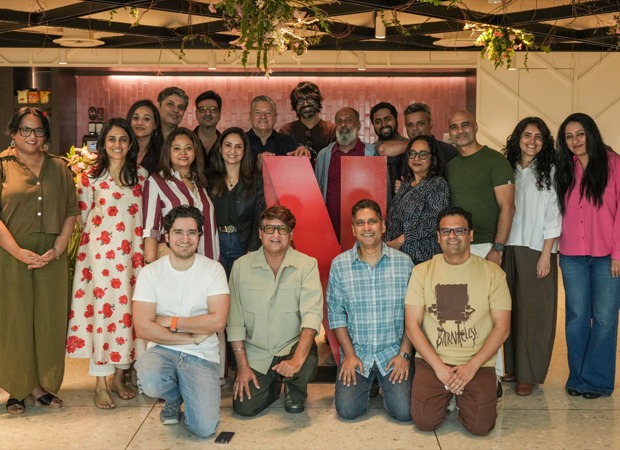
The ARC Centre is building AI systems that allow officials to visualise and prepare for flooding in real time. Photograph: (Risk Managemanet Association Of India)
“We need to demonstrate these solutions. Develop algorithms and stress-test them. Make them usable for cities,” he says.
The need for such a system became clear during the team’s fieldwork on flooding linked to the Tapi River in Surat. City stakeholders wanted a tool that could show flood risks in real time and help them decide what action to take, rather than another report explaining the problem after the damage.
That realisation led to the ARC Centre, a 2,000-square-foot command space at IIT Gandhinagar’s Research Park. The idea was simple: research needed to move beyond papers and presentations to support people making difficult decisions on the ground.
The centre brings researchers and city stakeholders together to build AI tools suited to Indian cities and their realities, rather than relying on standardised models developed elsewhere.
As Prof Bhatia puts it, “Indian cities are very different in their typology and architecture. We cannot just take models from the West and apply them here.”
That need for contextual intelligence shaped the Centre’s defining innovation: physics-guided AI.
How physics keeps the AI grounded
Flood models have traditionally used physics-based simulations to show how water moves through rivers and across land. These models can be accurate, but they often take a long time to run and require considerable computing power.
“In a flooding situation, you cannot wait for days,” says Dr Vivek Kapadia, former Secretary, Government of Gujarat, and Professor of Practice at IIT Gandhinagar. “You need a solution in a jiffy.”
AI models offer speed, but their answers may overlook the physical laws that govern how water actually moves. The ARC team decided to combine the strengths of both approaches.
“We coupled data-driven models with physics-based models,” Dr Kapadia explains. “The composite model gives us the speed of AI and the precision of physics.”
Physics ensures the conservation of mass, energy and momentum. “Your answers are now constrained by physics,” Prof Bhatia adds. “You cannot violate physics to get them right.”
Every monsoon brings familiar disruptions, but researchers at IIT Gandhinagar believe AI can help cities move from reacting to anticipating flood impacts. Photograph: (IIT Gandhinagar)
The result is a real-time, physics-guided AI system capable of:
-
Running rapid flood simulations
-
Conducting scenario and ‘mock’ preparedness exercises
-
Generating actionable, science-backed decision support
The models have already been stress-tested in complex flooding scenarios, from coastal and tidal interactions to dam-influenced river systems such as Surat.
The system’s intelligence is grounded in hydrology and hydraulics, allowing its outputs to remain scientifically explainable.
A digital twin that lets cities test solutions first
Flood maps typically answer one question: Where is the problem?
Cities ask another: What should be done about it?
The ARC Centre moves from diagnosis to prescription through digital twins, or virtual replicas that allow planners to test possible interventions before spending public money on them.
If a junction floods, should the city install a 50-horsepower pump or a 100-horsepower one?
If a drainage line is widened, how will the depth and duration of flooding change?
“Once we understand the magnitude of the problem,” Prof Bhatia explains, “we can embed the solution into the digital twin and test its efficacy on the computer screen first.”
Dr Kapadia underscores the philosophy: “We are not taking decisions for stakeholders. We are providing decision-support frameworks. Instead of contingent decisions, cities can take learned and informed decisions.”
The dashboard visualises water depth, velocity, the spread of flooding and its impact on infrastructure. It also integrates mobility.
“If there is rain of this amount,” Prof Bhatia notes, “how much traffic will build up, in what part of the city, and what you need to do: that layer is already functioning.”
The team combines the speed of artificial intelligence with the accuracy of physics-based models to generate rapid, scientifically grounded flood forecasts. Photograph: (IIT Gandhinagar)
The guiding idea is ‘Rain to Resilience’, combining flood forecasting, mobility modelling and operational scenario testing within one physics-guided AI ecosystem.
Why a flood model for the West may fail in an Indian city
One of the ARC Centre’s defining philosophies is contextualisation.
“Indian cities are very different in their typology and architecture,” Prof Bhatia notes. “We cannot just take models from the West and apply them here.”
Indian cities grow anisotropically, meaning unevenly and in different directions. They often blend historical cores with new expansions. Drainage systems may be incomplete, while data archives may be patchy.
The biggest challenge is data.
“If data is incomplete, no matter how beautiful your physics or AI model is, there is a high chance it will break,” says Prof Bhatia.
To overcome this, the team:
-
Entered into agreements with city governments
-
Cleaned and patched fragmented datasets
-
Developed low-cost indigenous sensors
-
Used innovative inference methods, such as identifying probable drainage paths from road networks
Crucially, all data pipelines are designed to remain within India, complying with emerging privacy and data-protection norms.
From a one-person lab to 25 people solving one urban challenge
The people building the system make this initiative distinctly campus-driven.
“When I started the lab, it was a single-person lab,” Prof Bhatia recalls. “Today we are 25 people working on a common mission.”
PhD scholars, BTech graduates and researchers power the initiative. An IIT Gandhinagar-incubated startup, AIResQ ClimSols Pvt Ltd, supports the dashboard and simulation tools.
Using virtual replicas of cities, planners can test drainage upgrades, pumping systems, and other interventions before investing public resources on the ground. Photograph: (Headlines India)
“Our students are not coming out with only bookish knowledge,” Dr Kapadia says. “They are equipped with real-world problem definitions and solution frameworks.”
The campus ecosystem, including research park infrastructure, incubation support and institutional backing, accelerated the journey from research to an operational centre.
Also preparing for heat, traffic and dam safety
Flooding may be the ARC Centre’s first operational vertical, but the team is building a broader climate-intelligence system.
The platform brings mobility, heat, infrastructure and citizen inputs into a layered digital twin framework.
It overlays rainfall simulations with traffic behaviour to anticipate cascading disruptions. “If there is rain of this amount,” Prof Bhatia says, “how much traffic will build up… that layer is already functioning.”
The team is also advancing urban heat-island modelling.
“We are not just modelling heat,” Prof Bhatia explains. “We are identifying optimal mitigation strategies using explainable AI, so decision-makers understand why a recommendation is being made.”
Immersive 3D visualisation allows planners to experience simulated flood environments through wearable devices.
“You can actually visualise the flooding in three dimensions,” says Dr Kapadia. “When decision-makers see it like that, the understanding becomes immediate.”
In parallel, the team is working with the Government of Gujarat to model downstream flooding from dams and estimate evacuation windows for vulnerable villages.
“If water is released from a dam,” Prof Bhatia notes, “we can simulate how it will travel downstream and estimate how much time different villages have before it reaches them.”
A waterlogging photo from your street could improve the model
Citizen participation forms another layer of the ARC Centre’s approach.
Its citizen portal allows residents to log waterlogging instances during rainfall events. The system automatically captures geo-coordinates, anonymises the inputs and runs AI-based verification filters before using the information to refine the models.
“If you want to go to the next level of volunteering, you can attach a photograph,” Prof Bhatia says. “You can even suggest whether it is a persistent problem.”
Residents can contribute geo-tagged reports and photographs of waterlogging, helping the AI system learn from real-world conditions and improve over time. Photograph: (CityChangers.org)
This feedback loop strengthens prediction accuracy over time. Each monsoon can help the system learn from more on-ground information.
The team describes the architecture as lightweight and modular, designed for replication across hundreds of Indian cities without heavy infrastructure requirements.
What it takes to make an AI model work inside a real city
For Amar Nath, CEO of the Airawat Research Foundation, the ARC Centre is an institutional mechanism that can help modernise governance.
Airawat, a Section 8 not-for-profit company established under the Ministry of Education’s AI Centre of Excellence for Sustainable Cities, functions as a bridge between academic innovation and on-ground implementation.
Registered at IIT Kanpur and partnered with IIT Gandhinagar, IIT Hyderabad, IIT Calicut and IISc Bengaluru, the foundation supports the development and deployment of AI technologies aimed at making Indian cities more efficient and sustainable.
At IIT Gandhinagar, two major verticals operate under this umbrella: urban flooding and energy management. While the core technology for flood modelling and climate-risk assessment is being developed by the campus research teams, Airawat plays a critical enabling role.
“Technology development is led by IIT Gandhinagar,” Amar Nath clarifies. “Our role is to bring cities into the picture, to coordinate with municipal bodies, electricity departments, and other stakeholders. Flooding does not affect just one department. It affects power systems, transport, and infrastructure. That interface is where we come in.”
From a one-person research lab to a multidisciplinary team of 25, students and researchers are developing solutions tailored to the realities of Indian cities. Photograph: (IIT Gandhinagar)
The ongoing pilot in Gurugram reflects this model. Airawat is working closely with city authorities to test how the ARC tools function in real conditions, how they integrate with existing systems, what operational challenges arise, and what sustainable frameworks can support long-term adoption.
For Amar Nath, India’s urban complexity makes such AI-enabled coordination essential.
“Different cities in India have different characteristics. Some are planned, some grow haphazardly. Resources are limited, and enforcement mechanisms are weak. Managing this through old systems is very difficult.”
AI, he argues, allows cities to move from fragmented responses to coordinated action across traffic management, waste systems, water-quality monitoring and air-pollution control.
“These are massive problems. In a routine manner, it is very challenging to implement solutions. But using AI, you can coordinate everything.”
Governance also depends on trained people, public awareness and institutions that understand how to use these systems.
“Technology is only one part. Implementation requires trained manpower, awareness, and institutions that know how to use these tools. Educational institutions and students have a very important role in scaling this up.”
Ultimately, he sees initiatives like ARC as foundational to India’s long-term development vision.
“To become Viksit Bharat, we have to grow, but we must grow sustainably. Otherwise, the costs of pollution and inefficiency will catch up with us. AI can play a very important role in balancing development and sustainability.”
Through its partnership with IIT Gandhinagar, Airawat is attempting to ensure that advanced research reaches the everyday functioning of Indian cities.
Can this campus-built system work across hundreds of Indian cities?
If scaled thoughtfully, the ARC model could redefine how Indian cities prepare for climate risks:
-
Anticipatory planning instead of reactive crisis management
-
Science-backed decision support instead of ad hoc interventions
-
Citizen participation integrated into AI pipelines
-
Indigenous, context-aware models rather than imported frameworks
Beyond flood prediction, the platform models how rainfall affects traffic movement, helping authorities identify congestion hotspots before they emerge. Photograph: (IIT Gandhinagar & Risk Management Of India)
The IIT Gandhinagar team presents ARC as an evolving system that learns, adapts and develops alongside the cities using it.
Its aim goes beyond predicting rainfall. It could help India’s cities test decisions, prepare their responses and practise resilience before the clouds gather.