

Local News
The draft plan would allow Boston to pursue up to 65 percent of construction costs for coastal resilience projects from the federal government.
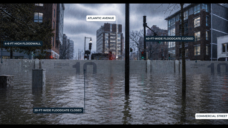
The U.S. Army Corps of Engineers has advanced a $10 billion coastal flood defense draft plan for Boston. One proposed option for downtown includes a floodgate spanning Commercial Street, shown here in a provided rendering. The visuals created by the City of Boston are concepts, not final designs. Rendering provided by City of Boston
Boston residents could eventually see new flood walls, berms, floodgates, and other coastal defenses stretching across 16 miles of the city’s shoreline under a plan released Monday that aims to protect neighborhoods from rising seas and increasingly severe coastal storms.
The draft plan from the U.S. Army Corps of Engineers (USACE) outlines more than 20 projects to close areas along Boston’s 47-mile coastline that are prone to flooding, with the baseline infrastructure expected to cost about $10 billion, Mayor Michelle Wu’s office said in a press release.
The draft report also details proposed infrastructure options for Boston’s coastal flooding protection, which include floodwalls, floodgates, and berms, Wu’s office said.
“Boston leads with bold action to protect our communities and our future,” Wu said in the release. “The future of our city depends on the steps we take now to build resilient communities. With more frequent flooding in vulnerable areas during extreme weather events, the Coastal Storm Risk Management Feasibility Study is critical to understanding how to protect inland neighborhoods most at risk and unlocking resources to take action.”
The US Army Corps of Engineers has advanced a $10 billion coastal flood defense draft plan for Boston. One proposed option for downtown includes a floodgate spanning Commercial Street, shown here in a provided rendering. The visuals created by the City of Boston are concepts, not final designs. – Rendering provided by City of Boston
The study, expected to be completed in 2028, would prevent an estimated $41 billion in flood damage by securing 65 percent of construction costs for coastal resilience projects from the federal government, according to Wu’s office.
About 40 percent of Boston residents live in areas vulnerable to coastal flooding, according to USACE. Without additional protections, officials estimate roughly 20,000 buildings could face severe flooding as sea levels rise and storms become more intense, Wu’s office noted. The plan focuses on the city’s shoreline in East Boston, Charlestown, Dorchester, downtown, the North End, and South Boston.
The draft is open for public comment through Sept. 18 before the study is finalized.
“Today marks a major milestone in our shared mission of community resilience,” Deputy Commander of the New England District of the U.S. Army Corps of Engineers David MacPhail said in a statement. “The reality is that doing nothing is not a viable option. Without action, the costs to public safety and economic vitality from coastal flooding will only be compounded.”
Sign up for the Today newsletter
Get everything you need to know to start your day, delivered right to your inbox every morning.


